Decision-Support for SAR Coordination

One platform. Three search domains.

Measure. Model. Plan.

SAROS brings scientific search planning to every domain a coordinator faces: drift modelling for maritime incidents, evidence-based lost person behaviour on land, and glide-range modelling for overdue aircraft. Monte Carlo simulation, probability heatmaps, IAMSAR search patterns and a full mission audit trail — in one secure platform.

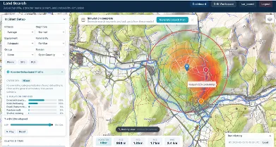
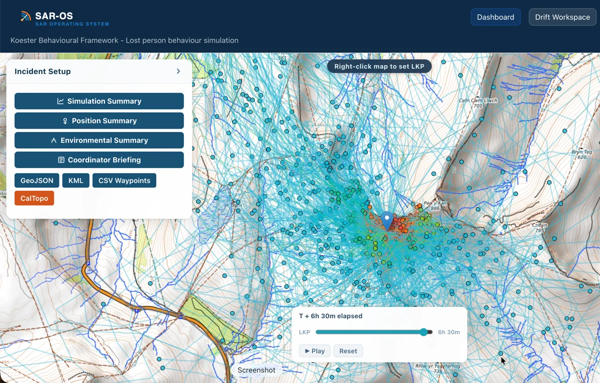
SAROS land search simulation showing Koester behavioural probability contours overlaid on terrain with lost person category profiles Terrestrial Search
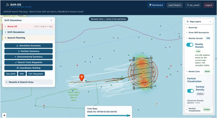
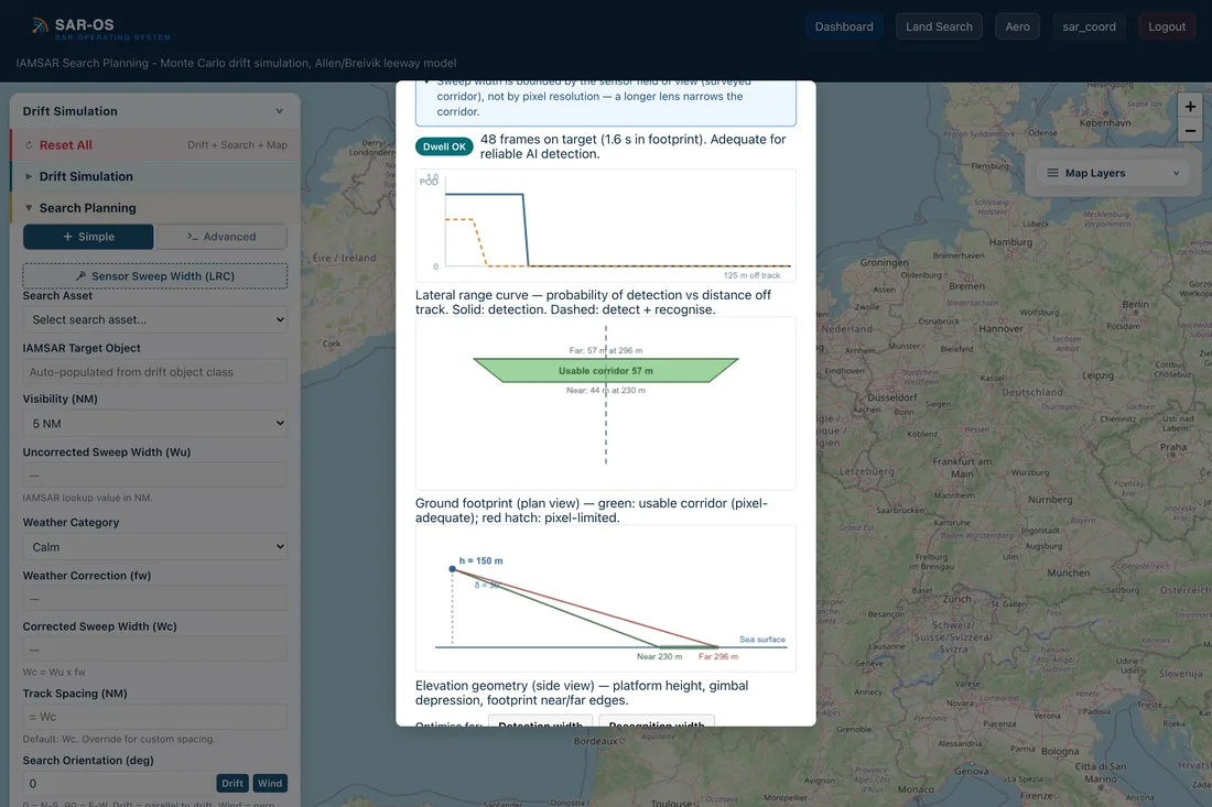
SAROS drift simulation showing Monte Carlo probability contours, search patterns and AIS vessel tracking on a maritime chart Maritime Drift
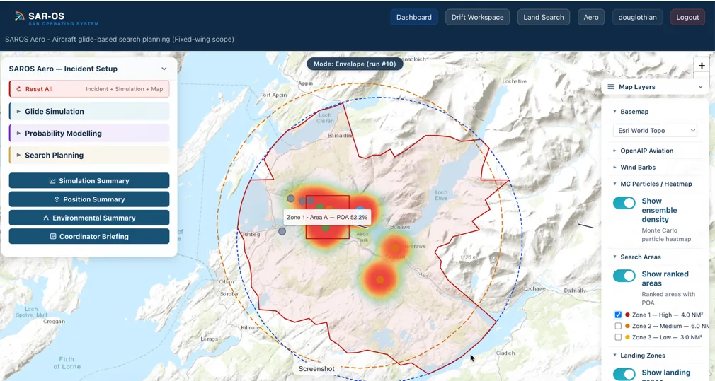
SAROS Aero showing a Monte Carlo probability heatmap inside a terrain-constrained glide envelope, with ranked search areas and per-zone POA for an overdue aircraft Aero New

Three Domains. One Operating Picture.

The same workflow everywhere: model the scenario, see the probability, plan the search. Learn it once, use it for every incident type.

Validated in the real world

Not a demo dataset — live drift trials with a police marine unit, and retrospective benchmarking against published search incidents. Read the Scientific Foundations →

Live Trials — NZ Police Marine Unit, May 2026

Both targets found inside the SAROS search area

  • Kayak — Auckland bay, tidal flow with offshore Pacific wind and wave. 8-hour, 15 km drift. Recovered 0.7 miles from the SAROS prediction, within the planned search area.
  • Person in water (survival posture) — same conditions. 8-hour, 7.5 km drift. Recovered 0.27 miles from the SAROS prediction, within the planned search area.
Retrospective Benchmark

Benchmarked against published incidents

Sixteen real search incidents described in Koester, Lost Person Behavior (2010), were retrospectively run through SAROS.

75% Find locations within P50
81% Find locations within P95
What Operators Say

“The land planning tool, awesome again!”

— Staff Officer, HM Coastguard

“Hugely insightful and an absolutely incredible system you have developed and produced.”

— Inspector, Police Search Advisor, Police Scotland

Maritime Drift

The Allen (2005) / Breivik (2011) leeway framework — the international standard for maritime SAR drift prediction — with live environmental forcing and Monte Carlo uncertainty modelling.

Allen/Breivik Leeway Model

The model decomposes object motion into downwind and crosswind leeway components calibrated from field experiments, with ocean current advection applied on top.

  • 15 object classes across four groups — persons in water, liferafts, small craft, other objects — with empirically derived downwind and crosswind leeway coefficients
  • Up to 2,000-particle Monte Carlo ensembles; stochastic jibing modelled per object class
  • Up to 168 hours (7 days) simulation with 30-minute resolution
  • Live wind, tide and current data from Open-Meteo, NIWA and national providers
  • IAMSAR search planning on the probability picture: parallel track, expanding square and sector search patterns with corrected sweep width, coverage factor and POD
  • COSPAS-SARSAT beacon import — decode the alert, pre-populate the search parameters, cut operator error and response time
1

Seed

Deploy particles at Last Known Position with uncertainty radius

2

Simulate

Propagate each particle using wind + tide + leeway coefficients

3

Define

Generate probability contours from particle distribution

From first alert to search pattern

One workflow carries the incident from beacon decode to a drift-advected search plan.

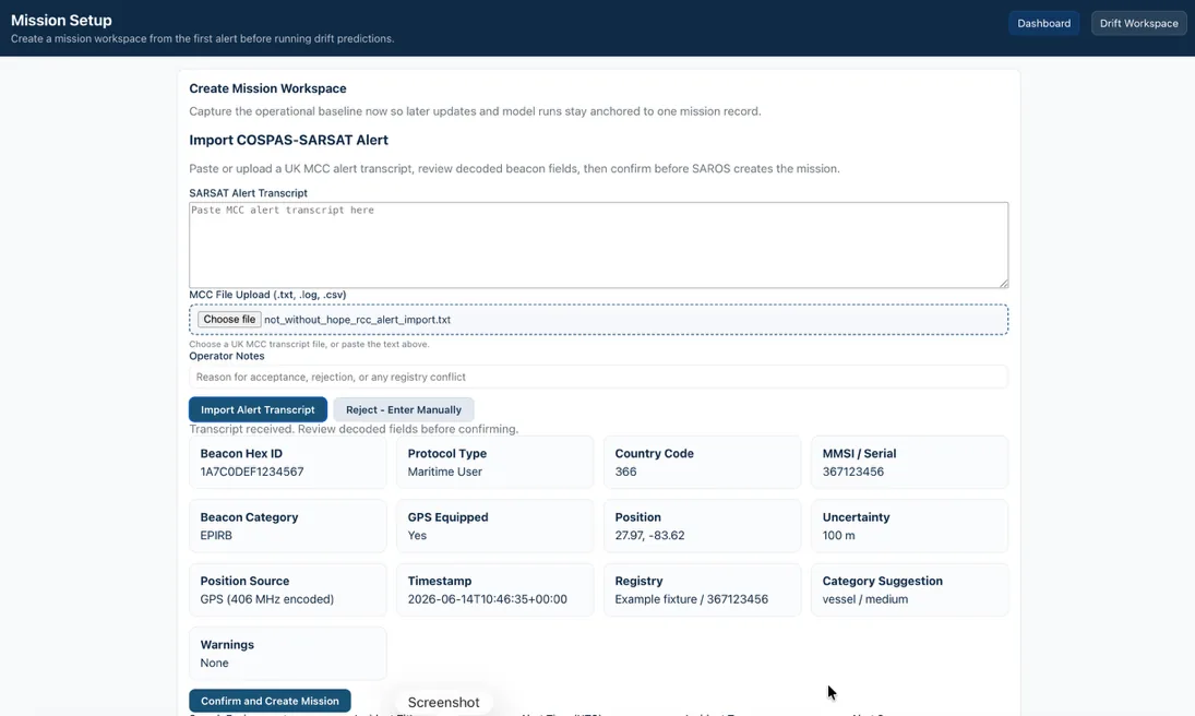
SAROS Mission Setup importing a COSPAS-SARSAT alert: MCC transcript decoded into beacon hex ID, protocol, position, uncertainty and registry fields for operator confirmation

COSPAS-SARSAT — Decode the Alert

Paste or upload the MCC alert transcript and SAROS decodes it: beacon hex, protocol, GPS position, uncertainty and registry lookup — reviewed and confirmed by the operator before the mission is created. No re-keying at 2am.

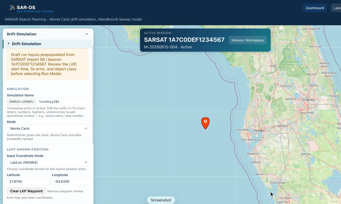
SAROS drift simulation pre-populated from the SARSAT beacon import, with the active mission banner anchoring the run to the mission record

Straight into the Model

The confirmed beacon seeds the drift simulation — last known position, datum time and fix error prepopulated, every run anchored to the mission record. The coordinator reviews the inputs and presses Run: fewer transposition errors, faster first search area.

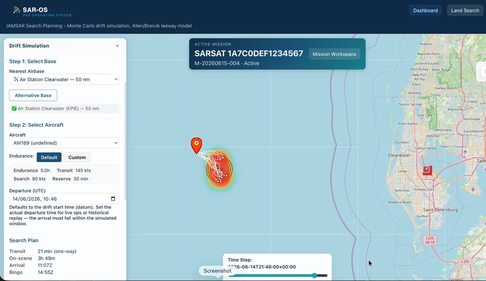
SAROS airbase and asset selection: nearest air station, aircraft type and endurance profile with computed transit, on-scene, arrival and bingo times beside the drift probability picture

Airbase & Endurance

Select the airbase and the aircraft; SAROS computes transit time, time on scene, arrival and bingo from the asset's endurance profile — so the pattern that follows is one the aircraft can actually fly.

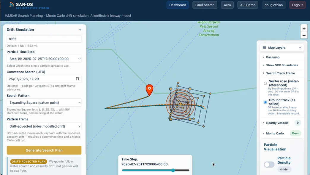
SAROS drift-advected expanding square search pattern riding the modelled drift, with the search track frame choice between water-referenced sector rose and GPS ground track

Drift-Advected Search

The generated pattern rides the modelled drift — each waypoint moves with the water column and casualty, not geo-locked to the sea floor. The crew chooses the frame: fly the water-referenced rose, record the GPS ground track.

From Probability to Pattern

SAROS generates the search pattern the situation calls for — serpentine parallel tracks for large drift areas, expanding square for a tight datum, sector search for a point last seen — sized to the particle spread at commence-search time, with waypoints, bearings and estimated search time on an exportable search card.

Priority Mapping

Nested probability contours define where to search first, second, and third — enabling optimal allocation of limited SRU time and fuel. The SAR Coordinator sees a clear priority map, not a single best-guess point.

Drift-Advected Patterns

The target is moving — the search area should move with it. Parallel track, expanding square and sector patterns advect with the water so effort stays on the drifting datum, not a fixed patch of sea the target left an hour ago. Pilots fly the constant-heading rose; the GPS ground track is the record.

Endurance-Aware Tasking

Patterns are planned against the asset that will fly them: airbase and asset selection, transit time, time on scene and bingo fuel. A green/amber/red feasibility check shows whether the search fits the aircraft's endurance before the card is issued — not after it launches.

SAROS Aero — Overdue Aircraft NewIn pilot

When an aircraft is overdue and the ELT is silent, the question is the same as every search: where do we look first? SAROS Aero answers it with physics, winds aloft and Monte Carlo probability — in the same workflow coordinators already know from Land and Drift.

  • Glide-range envelopes in three honest bounds: still-air, wind-adjusted, and terrain-constrained — assumptions stated on every output
  • Winds-aloft integration: pressure-level wind data resolved to altitude bands, applied as the aircraft descends
  • Terrain-aware: envelopes stop where the ground does, using the same elevation data as Land Search
  • 10,000-particle Monte Carlo ensembles over route, altitude and intent uncertainty — probability heatmaps and nested containment contours in the familiar SAROS visual grammar
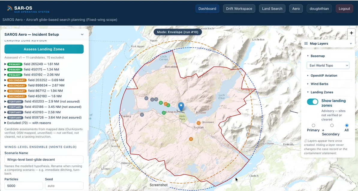
  • Ranked search areas with POD-based tasking, plus a landing-site overlay from open aviation data — rule airfields in or out systematically
  • Radar/GPS track import: feed the last known track straight into the model
SAROS Aero Landing Zone Advisor ranking reachable sites — primary, secondary and tertiary candidates with distances and exclusions — inside a terrain-constrained glide envelope
Air to Sea, One Click

If the glide envelope reaches the water, SAROS Aero hands the splash-point datum, time window and uncertainty directly to the maritime drift engine — one platform carries the search from cruise altitude to the liferaft. No legacy RCC tool chains an air incident into sea drift.

Live ADS-B — From Last Return to First Search Area New

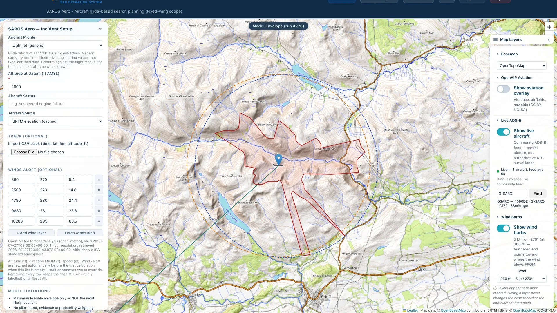
When an aircraft goes missing, its own transponder is usually the best evidence there is. SAROS puts the live air picture inside the planning tool — and turns the last returns into a search plan without a single figure retyped.

  • Live aircraft over the operational area — find any airframe by hex code, registration or callsign
  • One-click capture of the last returns as immutable, checksummed evidence in the case record
  • Datum position, time, altitude, track and groundspeed prefilled from the aircraft itself — no transcription under pressure, no lost minutes
  • Capture seeds the glide analysis; the coordinator always reviews and presses Calculate — the tool never decides alone
  • Honest feed status throughout: community feed provenance and data age shown on the layer — a planning aid, never presented as authoritative ATC surveillance
SAROS Aero with the Live ADS-B layer active: aircraft found by registration, feed age shown, wind barbs and terrain-constrained glide envelope over a topographic chart
Why It Matters to the Coordinator

The minutes after an aircraft drops off the picture are spent chasing radar replays and reading positions over the phone. With the last returns already in the case — datum, time and track intact — the first ranked search area exists while others are still transcribing.

SAROS Aero is decision support for search planning. Performance profiles are generic and conservative, every simplification is declared on the output, and residual probability outside the searched area is always shown — absence of probability is never treated as evidence of absence.

Direct CalTopo Integration

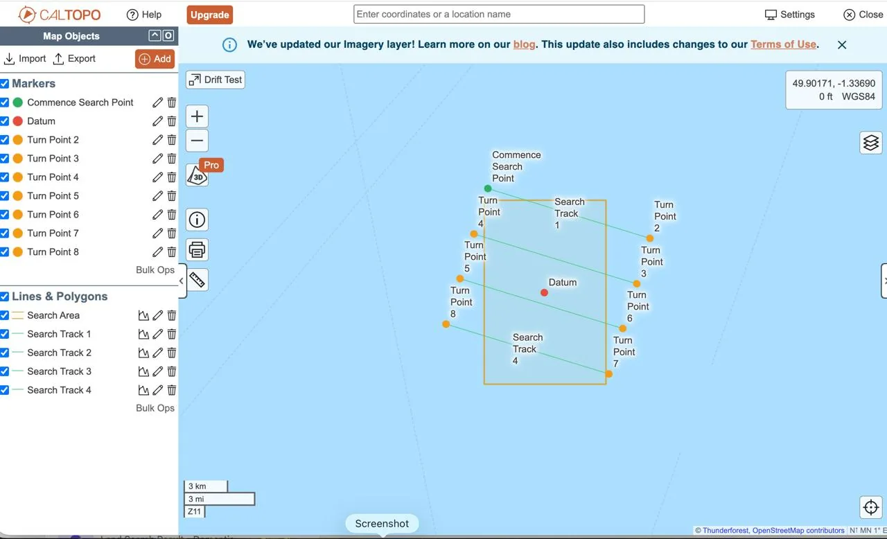
Push search data to CalTopo with one click — probability zones, search tracks and waypoints appear instantly on shared maps.

CalTopo map showing SAROS drift simulation search tracks, turn points and search area pushed via API

Maritime Drift

Search patterns, turn points and search areas from drift simulations push directly to a CalTopo map. Field teams see the search plan on their devices immediately.

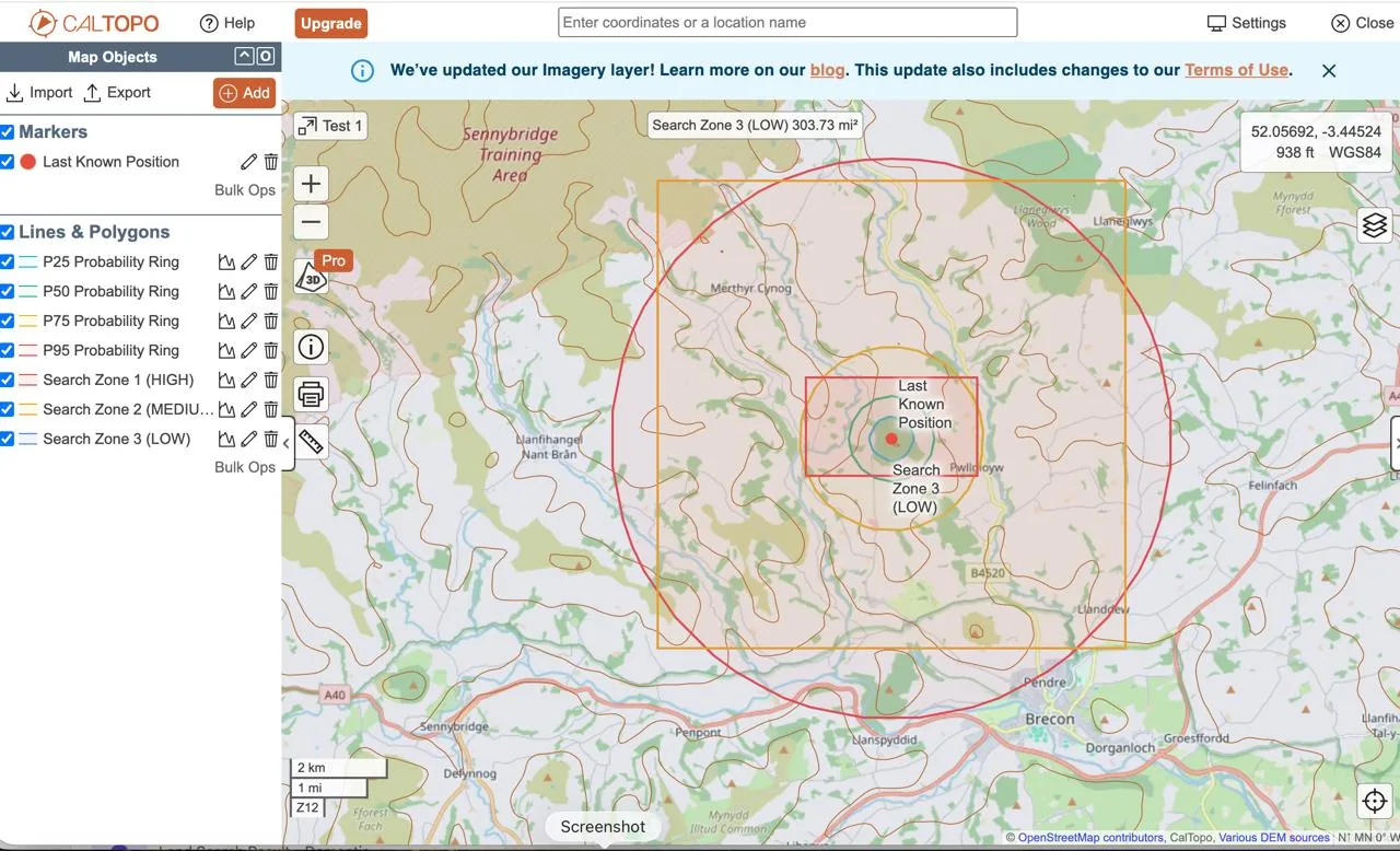
CalTopo map showing SAROS land search probability rings and search zones pushed via API

Terrestrial Search

Probability rings, search zones and the last known position push to CalTopo with styled layers — HIGH, MEDIUM and LOW zones are colour-coded for immediate situational awareness.

One-Click Push

Push complete search data to CalTopo from either Drift or Land Search with a single button press.

Styled Layers

Zones, tracks and markers arrive in CalTopo with SAR-standard colours and labels — no manual styling needed.

Shared Maps

Field teams, air assets and coordination centres all see the same live map — bridging the gap between planning and execution.

Complete Mission Platform

From first alert to case closure — integrated mission lifecycle management.

Immutable Mission Management

Every simulation lives inside a structured incident lifecycle. Planning assumptions are recorded as immutable revisions, tactical decisions are logged with rationale and linked to the run that informed them, and closure is formal — the mission record can be audited years later exactly as it stood at each decision point, never quietly rewritten.

Alert Assess Plan Execute Close

IAMSAR Search Planning

Automated search pattern generation with sweep width calculation. Parallel track, expanding square, and sector search — export directly to field teams.

Define Area Calculate POD Generate Pattern Issue Card

AIS Vessel Tracking

Real-time vessel positions via AISStream WebSocket. Identify available assets within search area for rapid tasking.

WhatsApp Integration

Field report ingestion and search card delivery via WhatsApp Business API. Bridge coordination centre to field teams instantly.

CalTopo Integration

Push probability zones, search tracks and waypoints directly to CalTopo with one click. Shared maps keep field teams and coordination centres on the same page.

Run Simulation Push to CalTopo Share Map

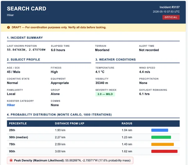
Automated Search Cards

Every simulation generates a structured Search Card — incident summary, subject profile, weather conditions, and probability distribution — ready to issue to field teams as PDF or DOCX.

SAROS search card showing incident summary, subject profile, weather conditions and Monte Carlo probability distribution table

Enterprise Security

Built for organisations handling sensitive operational data. Defence-grade access controls with operational flexibility.

  • Multi-Factor Authentication (TOTP)
  • Role-Based Access Control with persona-driven UI
  • Feature flags for staged capability rollout
  • Complete audit trail on all operations
  • Session management with configurable timeouts
MFA
RBAC
Audit
WCAG 2.2

Ready to transform your search planning capability?

Join SAR organisations modernising their coordination with science-driven decision support.